Saturday, July 9, 2016


Jefferson County’s Rivers: Florida’s Frontier

We drove to Mandalay at dawn, sliding an open boat into the Aucilla. Charlie Ward handled the tiller with Jack Carswell beside him. I rode amidships to take pictures.
            Charlie picked out his route along the curved riverbanks. “Sharp rocks hide under the surface of this water. One of them can rip this boat to pieces.”
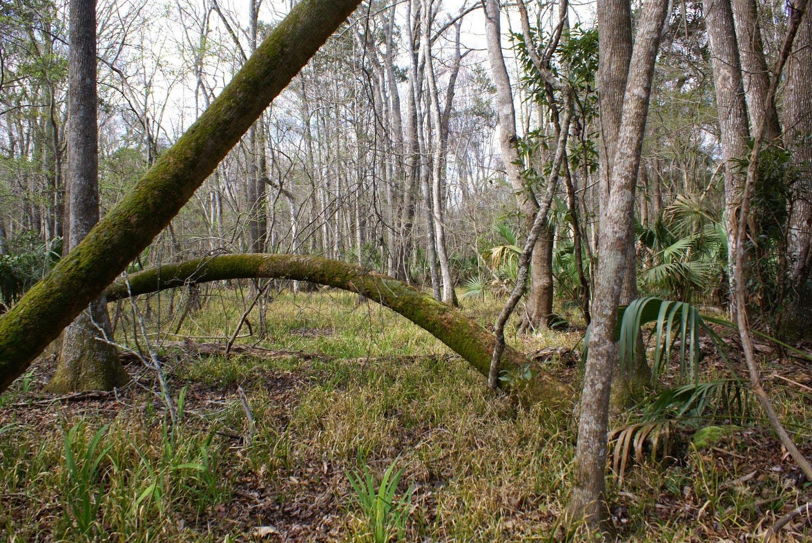
            We entered a maze of channels between curving stretches of marsh grasses dotted with palms, twisted cedars and willows. At Apalachee Bay Charlie pointed out Saint Marks Lighthouse and the almost hidden mouth of the Pinhook.

            Charlie said the Pinhook is mostly limestone under the reeds and grass. Trees rooted directly into slabs of moss-covered limestone hang over the water, closing out the sun.
The river narrowed and banks came closer until our boat stopped, the keel caught on a tree fallen across the water. Grabbing a nearby limb in one hand, Charlie yanked on the side of the boat and gunned the motor, sliding us across. 
            We finally turned to head back through the tunnel of trees. When we came out in the open the sky was dark. As soon as we ran clear of the narrow part of the river we sped up, ignoring the danger of hidden rocks. We were unsure whether to head back to the Aucilla or make for Saint Marks by open water where we would be safe.
            The sky turned purple and black, and a strong wind picked up. After a few miles of wind blowing in our faces the clouds moved on to our west. The sun came back out.
            As we turned north back into the Aucilla, we saw a gathering of Wood Storks resting on the limbs of a dead tree. One turned his back and spread his wings to show his eight-foot wing span.

            Overhanging tree limbs cast intricate patterns on the water. We turned left at Ward Island where Charlie stopped at a floating dock. Pointing to a path up the hill he said, “Climb up there and you’ll see a real family fishing cabin. Those folks hauled every stick of lumber in here on a boat.”
            The weathered structure looked shabby but sturdy. A covered porch protected a line of chairs backed up to the wall. I could picture a family enjoying the solitude--adults resting on the porch and children yelling as they played in the woods nearby. 
            Leaving the river, we followed the same route back to Monticello. Soon Charlie turned onto a narrow lane to show us the headwaters of the Wacissa River.
The Wacissa is pristine—as clear as the springs that feed it. Narrow and twisted, it is land-bound and finally disappears into the earth. Its waters connect with the Aucilla through a “Slave Canal,” cut by hand in antebellum times.

            A large part of Jefferson County is like these rivers, still unchanged in hundreds, perhaps thousands of years. Much of the route we covered on this trip is a land and waterscape untouched and undamaged, rare and beautiful.


Saturday, June 6, 2015

Anne Canoeing the Middle Aucilla River

This trip was recorded in video for a segment of the Dimensions program on WFSU. Rob and his helper -- I think his name was Jason -- did a great job of putting hours of filming and interviews of three people together to show the magnificence of this wild river. Robert Daniels was with us, and Doug Alderson with a friend of David's whose name I cannot remember.


David Ward put our canoe in at Lamont at 9:00 AM. He paddled and I took pictures. It took us until 5:00 PM to reach a ruin of a railroad bridge in south Jefferson County. The only locating markers are the standing pilings that once held up the trestle. We exited the river where there was once a town called "Cash Money."

As we moved with the current down river we worked our way around many downed trees. Most of them reached almost completely across the wide river, leaving only a narrow place to canoe or kayak around. We finally found one place impossible to pass so we portaged around taking the opportunity to straighten up and stretch our backs.

David and Robert had checked the passage only a few days earlier, but the river was lower and we finally came to a dead fall we could not go around or under or even pull our craft to the bank and portage around. I sat on the fallen tree, praying my camera was safe as the men pushed the canoe over the log behind me. It was tricky, but I made it back into the canoe without a mishap. All safely over,  we continued down the river.

It's plain to observe the interesting phenomenon of the different soils from one side of the Aucilla to the other. On the Taylor county side we could clearly see the Florida sandy soil and on the Jefferson County side the heavier clay soil that gives its name to the "Red Hills of Florida." Part of our interviews included a discussion of the effect the difference in the soils made for the Apalachees of the Red Hills and the tribes who lived on the sandy soils of eastern Florida. The Spanish traveling across this area commented in their dairies on the larger size and strength of the Apalachee, a likely result of better and more abundant food grown in better soil.

Friday, May 1, 2015

The Treasures of Jefferson County Florida

SECRET TREASURES IN JEFFERSON COUNTY FLORIDA

Monticello is our county seat. Eight miles away, give or take a few steps, you find Lloyd, Wacissa, Waukeenah, Lamont, Aucilla and a couple of villages that are only a place name today, such as Ashville and Fanlew. The eight mile distance is easily explained. A horse or mule and wagon with a farmer and his family sitting atop produce or perhaps simply riding along could easily make a sixteen-mile round trip to the county seat on Saturday or Court day. Early Indian scares required an active militia, men who easily made the eight-mile trip by horseback on Thursday afternoons to drill under the Meeting Oak. 


Jefferson County is about the 12th or 13th Florida county, created in 1827, but settled earlier. A Mr. Robeson or Robertson kept a trading post here from the early 1820s.  The town that grew up around it was called Robeson's Corners. The town’s name was changed to Monticello in 1827 and as with the county name, honoring Thomas Jefferson.


Our treasures are simple, and easily overlooked until you stop and study a while. High ground, hammock to wetland, our land rolls sweetly and is covered in as many shades of green as the fields of western Ireland. This was the favored land of the Apalachees, rich farmland where they grew their sustaining crops.

The Apalachee's farming practices included burning to keep the fields clear. From the time the United States acquired the territory in 1819 these rich open fields were called "Old Fields" and avidly sought by settlers for their plantations. Men came to the area ahead of their families to select and stake out patents that included "old fields" that would allow them to plant a crop immediately. The first-comers didn’t have to spend a year or more clearing away thick stands of pine and oak before plowing. 


Jefferson County forests are still thick and dark green, full of shadows, formidably dense. The extensive flatwoods of the south part of the county are secret to all but hunters and timber men seeking stands of towering cypress—formidable and forbidding forests. Tales abound of bears, panthers and other wildlife lurking in the scrub.

There is an ancient legend of a volcano told and re-told by Native Americans and area settlers. Parties searching for the volcano tell of finding a strangely shaped hill deep in the flat woods. Huge stones are scattered about the hill. Some speculate that this hill may be the site of a peat burn or an underground gas fire. Then again, searchers may not have found the site of the volcano.


The rivers are pristine. Fed by five springs, the Wacissa’s water is icy cold and delightfully clear. A short distance south of the headwaters the Wacissa is augmented by the generous flow of Blue Spring. The Wacissa is confined to the lower central part of the county and joined to the Aucilla by a canal dug by slaves. The “Slave Canal” was designed to move cotton to the Apalachee Bay for shipment to market. 


The Aucilla River forms Jefferson County’s eastern boundary with Taylor County. This river starts in southern Georgia, just below Thomasville and meanders the full length of the county to flow into the Apalachee Bay and the Gulf of Mexico. Not far from Lamont in the southern part of the county, it disappears underground to reappear in small, medium and large windows in the limestone locals call “Sinks.”

The “Aucilla Sinks Trail” follows the underground river, wandering from the Taylor to the Jefferson County side. Sinks range in size from simple cracks in limestone to beautiful small lakes decorated with floating islands of lilies.

The river reappears below Nuttall Rise, running deep and wide around Ward Island, curving into Apalachee Bay and the Gulf. Along the high banks stands of cypress, mixed oak and scrub enclose and reach out into the water. As the water moves into the bay long stretches of saw grass and clumps of palms create a disconcertingly tropical appearance.


You pass the spot on the Taylor County side of the river where the Confederate Salt Works attracted repeated raids by the Federals. Crossing the top of Apalachee Bay the middle cut curves northwesterly and turns into the hidden Pinhook River that sweeps serenely down from the eastern flatwoods part of the Saint Marks Wildlife Refuge. 


On top of our rich and treasured land and rivers--or our deep and broad history as one of the oldest towns in Florida, Jefferson County is the seat of north Florida's high southern culture. This can be experienced during a luncheon or dinner in the restored 1833 Wirick-Simmons House or the Camellia luncheon in the Budd-Carswell house. It is most obvious in the graciousness of the people, many who are descendants of the county's founding families. 


Monday, March 23, 2015

A Different sort of Beautiful

David Ward gave me a priceless canoe trip on the upper Aucilla River last week. The cypress trees are not out yet - the river was out of its banks - We saw ducks and other water birds -- what a wonderful friend.

We put the canoe in the water at Sneads and one other boat unloaded right after we did, but it turned up the river and was out of sight and sound in minutes. We had three plus hours of precious silence. I took several hundred pictures and sometimes pulled on bushes to help the canoe along as David paddled..

The light made mesmerizing reflections in the water. They seemed to change the shape of the water and almost made me want to explore the shadowy underwater forest.

Here are pictures -- words cannot describe the serene beauty. I wondered the whole trip--why weren't there dozens of canoes on the water?


Tuesday, August 19, 2014


BIRDS IN JEFFERSON COUNTY
by Anne H Holt
Monticello, FL


Wood Storks on the Aucilla
On boat trip down the Aucilla to Apalachee Bay and up the Pinhook River I saw a gathering of Wood Storks. There were at least nine birds, resting on the limbs of a dead tree. One particular stork turned his back to us and spread his wings. He appeared to pose as I snapped shot after shot. It’s hard to imagine from a picture how big Wood Storks really are—they sometimes show a wing span of eight feet.

A Swift in the old jail
Sleek, black and timid, I first thought this creature was a large bat, but closer it definitely is a bird. It appears to be attempting to hide in the shadows in the basement staircase of the old jail on Dogwood Street. One or two windows in the building are broken so she found a fine home.

A Watch Hawk on High Street
Songbirds usually greet the day with joyous song in our huge oaks. One screams cheap, cheap, cheap until you want to spend the day shopping. One morning I woke to an almost eerie silence. No bird sang. This hawk is the reason. He perched high in a tree among the Spanish moss and seemed to regard me as an unwelcome intruder. Even the squirrels stop chattering and stay hidden until he moves on. He nests in the park across the street.

An Owl in the Monticello Ecological Park
This bird apparently does not like humans in his park. He lies in wait for a certain runner who regularly visits the park in the early morning --bursts from under the boardwalk—beating the air with his wings to make a startling noise—certainly hoping to frighten the human intruder away

Turkeys in the Monticello Ecological Park.
A flock of wild turkeys, I don’t know how many, hide in the old growth forest—enjoying the freedom and safety of acres of dense, untamed wilderness with plenty of water. These birds occasionally forget to be circumspect and gobble their joy at the abundance of food nature places before them.
Mississippi Swallowtail Kite in the Monticello Ecological Park

This bird was just visiting—skimming along -- twitching his tail. Darting away into the tall trees.

Here is a list other watchers have seen in August in the Monticello Ecological Park.

1 Red-shouldered Hawk 1 17 Aug 2014 David Simpson
2 Red-bellied Woodpecker 1 1     7 Aug 2014 David Simpson
3 Carolina Chickadee 2 1 7 Aug 2014 David Simpson
4 Tufted Titmouse 4 1 7 Aug 2014 David Simpson
5 Carolina Wren 6 1 7 Aug 2014 David Simpson
6 Northern Parula 1 1 7 Aug 2014 David Simpson
7 Northern Cardinal 6 1 7 Aug 2014 David Simpson
8 Downy Woodpecker 1 1 6 Aug 2014 Trail Staff
9 Pileated Woodpecker 2 16 Aug 2014 Trail Staff
10 White-eyed Vireo 1 1 6 Aug 2014 Trail Staff
11 Blue Jay 1 1 6 Aug 2014 Trail Staff
12 American Crow X 1 6 Aug 2014 Trail Staff
13 Great Crested Flycatcher 1 3 Aug 2014 Carol Miller
14 Yellow-throated Vireo 1 3 Aug 2014 Carol Miller
15 Fish Crow 1 1 3 Aug 2014 Carol Miller
16 White-breasted Nuthatch 1 13 Aug 2014 Carol Miller
17 Yellow-billed Cuckoo 1 7 Aug 2014 Carol Miller
18 Red-headed Woodpecker 1 7 Aug 2014 Carol Miller
19 Black-and-white Warbler 1 7 Aug 2014 Carol Miller
20 Cattle Egret 1 3 Aug 2014 Andy Wraithmell
21 Turkey Vulture 1 3 Aug 2014 Andy Wraithmell
22 Mississippi Kite 1 3 Aug 2014 Andy Wraithmell
23 Mourning Dove 2 3 Aug 2014 Andy Wraithmell
24 Chimney Swift 1 3 Aug 2014 Andy Wraithmell
25 Blue-gray Gnatcatcher 1 3 Aug 2014 Andy Wraithmell
26 Northern Mockingbird 2 3 Aug 2014 Andy Wraithmell
27 Hooded Warbler 1 3 Aug 2014 Andy Wrai

Tuesday, May 20, 2014

Finding the Red Hills:
The Most Beautiful Scenic Drive in Florida


The scenic, landscaped corridor linking historic districts in Monticello and Tallahassee is best known as Fred Mahan Drive. Easily the most beautiful twenty-five miles in Florida—it started as a tribal path—became the Old Spanish Trail and is now Route 90, once the main east-west route across Florida.
In 1935, at the height of the depression in our area, Mahan’s nursery of Monticello, then one of the largest plant and tree nurseries in the Southeast, donated thousands of shrubs and trees to beautify the right-of-way along this drive. With federal funds, Jefferson County Highway Department employed thirty-five men at 30 cents an hour to plant the donated shrubs, providing desperately needed jobs at what was a fair rate of pay for the height of the great depression.
The highway right-of-way background, middle and foreground plantings consisted of pyracantha, arbor vitae, flowering crape myrtle, ligustrum and some palm trees. Recent additions of smaller crape myrtles, planted every 100 feet, from the intersection of I-10 and US 90 east of Tallahassee, for twenty plus miles to the edge of Monticello present a spectacular range of brilliant colors throughout the early summer months.
For most of the year the shrubs are lush and green. In winter, bare of leaves and flowers, their cinnamon branches are still attractive. In late April crape myrtles are covered in deep green leaves. In mid-May many of the shrubs begin to produce large clumps of conical white flowers followed by old-fashioned “watermelon pinks” and a few days later the gorgeous dark reds. When the crape myrtles are blossoming this two-lane road running east from Tallahassee to the historic City of Monticello, Florida is a never to be forgotten treat, easily the most beautiful drive in Florida.
This beauty is worth seeing and preserving. Some Florida citizens demonstrated their appreciation in the 1990’s when early one Monday morning a Florida Department of Transportation crew discovered vandals had attacked and all but destroyed an expensive, high-tech wood chipping device. Apparently tired of mowing around bushes, the crew started to use this machine to “clear” the shrubbery from both sides of Highway 90 east late that Friday afternoon. After cutting down and chewing up a few crape myrtles and other shrubs they cut the machine off and left for the weekend.
Luckily, a reporter saw the big machine devouring the crape myrtles on Friday and submitted a story to the local paper. The outcry was almost unbelievable. Telephone lines seemed to catch fire from Monticello to Tallahassee to Washington, DC. Angry people called to demand help from Jefferson and Leon County elected representatives to stop the destruction.
Sometime Saturday or Sunday evening, someone—a nature lover I assume, cut the hydraulic lines, rendering the valuable machine useless. This action and subsequent news stories and the frantic, angry telephone calls stopped the desecration and saved the beauty for us to enjoy today.
If you slow down a little so you can enjoy the wonderful view, you can see an occasional sturdy-looking palm tree tucked in behind the crape myrtles. The Ligustrum blossoms just before the Crape Myrtles, the large rounded shrubs appear dusted with snow and smell as sweet as honeysuckle. You will even see a few overgrown and badly misshapen arbor vitae, but not a single pyracantha.

Monday, March 10, 2014

Monticello's Beautiful and Mysterious Setting

The Jefferson County Florida Flatwoods

The Flat Woods of Jefferson County Florida are a world out of time. This remote and mysterious area is almost impenetrable and unknown except by a few hunters, fishermen, and scientists. The Flat Woods are located in South-central Florida, at the edge of the Apalachee Bay and the Gulf of Mexico.

These remote tangled woods and swamps are bordered on the east by the Suwanee River and on the west by the Wakulla. The area is split by the mysterious, disappearing Aucilla River and graced by the spring-fed Wacissa and the lost Pinhook.

These woods and swamps boast as diverse a collection of botanical specimens as any place in the world not a rain forest. Sinkholes pierce the porous limestone underlying the jungle-like growth of oak, pine and palm, adding to the ancient mystery.

The treasures of this vast crescent, reaching almost 100,000 acres, lie deep. They are hidden from all but scientists, trained divers and special equipment. The knowledge hidden here is covered by a blanket of rotted plant life to a remarkable depth; a covering that provides anaerobic security for the remains of humans and animals waiting through centuries to tell the story of the settlement of North America.

This area has been of great interest to anthropologists, archaeologists and other scientists for many years. The evidence they have gathered through several “digs” suggests eons of settlement by humans, possibly some of the earliest settlement in North America.

The pressing question developing as all of this evidence accumulates is whether or not the first settlement in North America came from the east or from the northwest. Could the first North American settlers have come across the ice from Europe? The answer lies waiting in the Flat Woods under a deep blanket of plant waste, protected by a lack of oxygen and waiting to be uncovered.